Ottawa Surrounding Areas

Ottawa Surrounding Areas

kanata mapk

The old city of Ottawa was amalgamated with the suburbs of Nepean, Kanata, Gloucester, Rockcliffe Park, Vanier and Cumberland, and the rural townships of West Carleton, Osgoode, Rideau and Goulbourn, along with the systems and infrastructure of the Regional Municipality of Ottawa-Carleton, to become one municipality.

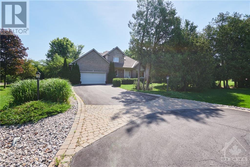
Only a short distance from Canada’s capital city Ottawa, is the vibrant suburban community of Kanata. In 2001, Kanata amalgamated with the new City of Ottawa. Although the area is a bedroom community to its larger neighbour, it also has its own lively and growing business center. Once dominated by the agricultural industry, Ontario’s Kanata is now home to a variety of hi-tech employers. Along with a growing business culture, there are also many attractions to explore in the area. Kanata boasts a lively nightlife scene, with venues that range from energetic nightclubs to laid back restaurants, and plenty of family-friendly activities. Just a stones throw away is The Canadian Tire Centre which is home to the Ottawa Senators and it also holds the biggest shows and the best events that the nation’s capital has to offer.

Kanata has many sub-communities: Beaverbrook, Bridlewood, Glen Cairn, Harwood Plains Kanata, Kanata Lakes, Kanata West, Kanata Estates, Katimavik-Hazeldean, Lakeside, Malwood, Marchhurst, Marchwood, Morgan’s Grant, South March, South March Station, Strathearn and Town Centre (Kanata)
1

Beaverbrook is a suburban neighbourhood in Kanata North Ward in the city of Ottawa, Ontario, Canada. It is located within the former city of Kanata. Beaverbrook is known for its hedged houses and community facilities. The neighbourhood is bounded by the Kanata North Business Park to the north, March Road to the east, Campeau Drive to the south and Knudson Avenue & Weslock Way to the west. According to the Canada 2011 Census, the total population of the neighbourhood was 5,182. Beaverbook is the first and oldest residential neighbourhood in Kanata.
The area was an agricultural part of March Township until the 1960s when developer and planner Bill Teron set about creating a planned Garden City community. The city centre didn’t grow as he had originally planned, but eventually with its residences, hi-tech businesses and commercial services became the City of Kanata, founded in 1978. Beaverbrook is named after Sir Max Aitken, Lord Beaverbrook.
Kanata Lakes also known as Marchwood-Lakeside is a neighbourhood in Kanata North Ward in the west end of the City of Ottawa, Canada. Prior to amalgamation in 2001, it was located within the City of Kanata. It is located north of the Queensway, west of Beaverbrook, east of Terry Fox Drive, and south of Morgan’s Grant. Kanata Lakes is located about 20 km west-southwest of Downtown Ottawa. Kanata is one of the largest suburbs of Ottawa, Ontario, Canada.
Kanata has a population of 80,781 as of 2011 and is growing rapidly. Before it was amalgamated, it was one of the fastest growing cities in Canada and the fastest growing community in Eastern Ontario. Located just to the west of the National Capital Commission Greenbelt, it is one of the largest of several communities that surround central Ottawa. It is a planned community and an important hi-tech centre.
3
Kanata Lakes has several sports associations with regular activities, the most visible being the large golf clubs (one of them right in the middle of the town), the sailing club and the bicycle club. There is also Kanata Soccer, March Kanata Tennis Club, Kanata Blazers minor hockey and March Kanata figure skating club.
4
Kanata Lake Schools Include:

  • All Saints Catholic High School
  • St. Gabriel School

Notable buildings and institutions

  • The Kanata Centrum power centre; together with adjacent developments, Ottawa’s third largest shopping centre.
  • AMC Kanata 24 Theatres, the largest movie theatre in Ottawa.

Links:
Golf Club: http://kanata.clublink.ca/
Kanata Sailing Clubs http://kanatasailingclub.com/
AMC Theatres: https://www.landmarkcinemas.com/kanata
Ottawa Mountain Bike Association: http://ottawamba.org/cms/march-highlands-map/

The goal at Amberwood is to provide a venue for the enjoyment of sport and recreation while interacting with neigh-bours and friends and to meeting new people. Our members are a friendly group from all around the Ottawa area. The Club is always open to new members and is continually creating new and fun ways to bring the community closer together. Amberwood holds various events open to members and guests, such as themed pool parties, pub nights in the mem-bers’ games room, Christmas dinners and, as always, fundraising golf tournaments. Amberwood Village Golf & Country Club’s tennis program is open to all ages of players.
There are three well-maintained hard surface courts. The Club has also collaborated with the National Tennis School in Ottawa to offer tennis lessons. Amberwood Village Golf & Country Club boasts a heated, salt water outdoor swimming pool for you and your fami-ly’s enjoyment. The pool is 60 feet (18m) long with a depth of 3 feet 6 inches at the shallow end and 9 feet at the deep end. The pool is open every day from mid-May until mid-September . Aquafitness classes are organized from mid-June until late August for adults. Members are invited to borrow from the Library of growing books as well as to donate any gently-used books you may not want any more. Members are also invited to use the Games Room. The Games Room is a cozy place to enjoy a game of pool, darts, cards, etc. The comfortable couches may also be a nice place to relax with a book from the library or to have a quiet conversation with friends.
Nepean is a part of Ottawa, Ontario, located west of Ottawa’s inner core. It was formerly a city in its own right until amalgamated with the Regional Municipality of Ottawa-Carleton in 2001 to become the new city of Ottawa. However, the name “Nepean” continues in common usage in reference to the area. The population of Nepean is about 180,000 people.
Although the neighboring municipality of Kanata formed the entrepreneurial and high tech center of the region, Nepean hosted noted industries such as Nortel Networks, JDS Uniphase and Gandalf Technologies. As with the rest of the National Capital Region, however, Nepean’s economy was also heavily dependent on federal government employment. Most of Nepean’s employed residents commute to downtown Ottawa or Kanata for work.

Nepean City Hall : Ben Franklin Place

6
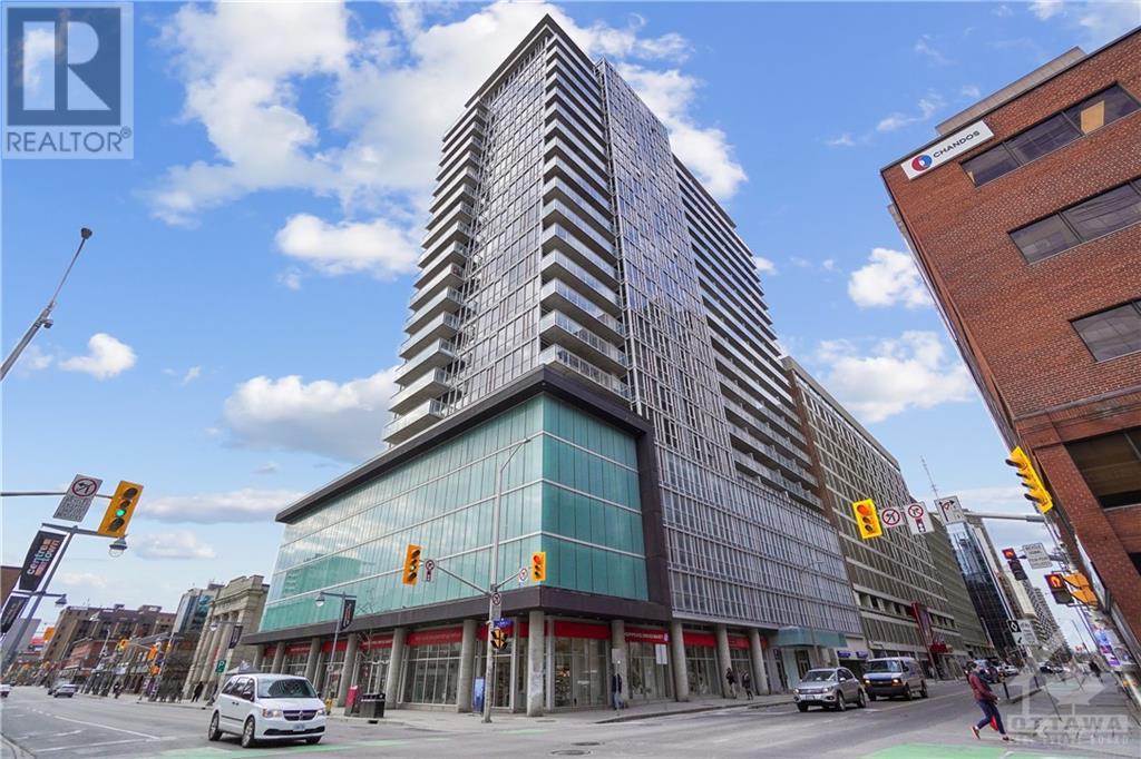
Ben Franklin Place, located in Centrepointe, was formerly the city hall for Nepean until it became a part of Ottawa. Now, it serves as a government office and client service centre, as well as continuing to be home to a branch of the Ottawa Library and the Centrepointe Theatre.

Links:
Nepean Museum: http://www.nepeanmuseum.ca/
Centrepointe Theatre: http://www.centrepointetheatre.com/
Nepean Sailing Club: http://nsc.ca/
7

Stittsville is a suburban community, part of the City of Ottawa, Ontario, Canada. It is within the former Goulbourn Township. A part of the National Capital Region, Stittsville is immediately to the southwest of Kanata, and about 31 km (19 mi) west of Downtown Ottawa. The urban part of the community corresponds to Stittsville Ward on Ottawa City Council. Since the extension of the Queensway in the 1970s made travel from Ottawa quicker and easier, Stittsville has experienced rapid growth; it transformed from a quiet farming community of under 500 people to a suburb of 20,000, in just over 25 years.
Many residents are employed in Ottawa’s high-tech industry or the federal government. Further growth is expected in the near future with the development of neighborhoods such as Jackson Trails (523 Overland is located in Jackson Trails) and Kanata West to its north, Fernbank to its east and south and West Ridge to its west. In the next 10 to 20 years, Stittsville’s population is expected to exceed 30,000.
8
Links:
Stittsville Village Association: http://www.stittsvilleva.com/
Stittsville Central: http://stittsvillecentral.ca/
Orleans is a rapidly growing Ottawa neighbourhood with a current population of close to 110,000. It borders the Ottawa river along the Eastern side of the city and is just 16 km away from the cities core downtown area. You’ll find a good selection of both condos and homes for sale in Orleans ranging from $200,000 all the way to listings over $500,000. Orleans has a strong french speaking community and is well known for it’s character, charm, welcoming neighbourhoods and quality schools.
The main highway linking Orleans to central Ottawa to the west is officially known as Ottawa Regional Road 174 and forms part of the Queensway.
Highway exits are: Trim Road, Tenth Line Road, Jeanne d’Arc & Place d’Orléans Dr.
Today, Orleans spans the municipal wards of Orleans, Innes and Cumberland. Orleans is one of 3 areas of the post-amalgamated City of Ottawa to contain a significant francophone population, hence the city’s name, Orléans.
The heart of Orléans is almost 4 km of St-Joseph Boulevard in the Ottawa neighbourhood of Orléans. If you are new to the area, St-Joseph runs parallel to Highway 174. The district starts at Prestone Drive to the east, and runs west to Youville Drive, with pockets at Centrum Boulevard, Place d’Orléans Drive and Jeanne d’Arc Boulevard.
9
Orleans has over 20 neighbourhoods, some of the well-known enclaves inside Orleans are: Avalon, Chapel Hill, Fallingbrook, and Queenswood Heights.
Orleans Online ticket system, rates and bus schedules: https://www.orleansexpress.com/en/
Fitzroy is an historic township originally part of Carleton County in eastern Ontario, Canada. Fitzroy was located in the western part of the county, bordered to the northeast by Torbolton Township, to the southeast by Huntley Township, to the southwest by Pakenham Township and to the northwest by the Ottawa River. The township was established in 1823. The first permanent settler is believed to have been Charles Shirreff around 1818. Shirreff founded the settlement of Fitzroy Harbour in 1831. The township was an important centre of the timber trade during the 19th century. In 1974, the township was amalgamated with Huntley and Torbolton to form West Carleton. In 2001, West Carleton became part of the new city of Ottawa. Fitzroy took its name from Sir Charles Augustus FitzRoy, son-in-law to Charles Lennox, 4th Duke of Richmond who was Governor General of British North America from 1818 to 1819. According to the Canada 2011 Census, the Township had a population of 4,518 Villages within the township included: Galetta, Kinburn, Antrim.
Links:
Fitzroy Harbour Community Association: http://www.fitzroyharbour.com/
Fitzroy Harbour Soccer Club: http://fitzroysoccer.com/
Fitzroy Provincial Park – Ontario Parks: https://www.ontarioparks.com/park/fitzroy
The Village of Carp in the Township of Huntley lies in the western-most ward of Ottawa, approximately ten kilometers west of Kanata. The population as of 2012 is estimated to be approximately 2000. The official boundary for the village was established in 1979 and Huntley Township was amalgamated with the City of Ottawa in 2001. The village sits on the edge of the Carp Escarpment (or Carp Ridge), a geological fault running through the Carp River Valley. The Carp Hills and the Carp River are other principal geographic characteristics of the village terrain. One of the main streets, Donald B. Munro Drive, was once a part of the Trans-Canada highway until the building of the “Carp bypass” as part of highway 17/417 in the mid-1960s. Carp has been a major centre for agricultural activities since the 1800s. The Carp Agricultural Society and the annual Carp Agricultural Fair date back to 1863.
The Carp Fair (2013 marks the 150th Fair) draws visitors and participants from all over Ontario, Quebec, and the New England States. The Carp Farmer’s Market is held every Saturday from April/May to October on the southern part of the Fair Grounds and attracts regular visitors from Ottawa and many of the towns and communities around Carp. Located a short distance from the Carp Fair grounds is the other well-known feature of Carp, namely the Diefenbunker, built in the 1960s to house the principals of the Federal Government in the event of a nuclear attack on Ottawa.
11 12
Links:
City of Carp Website: http://www.carp.ca/
Carp Facebook Page: https://www.facebook.com/CARP/
Carp Fair: http://carpfair.ca/
Dunrobin is a rural village located about 22 miles north west of Downtown Ottawa. Dunrobin lies within a valley, separated from the Ottawa River by an escarpment, and is located at 45.18° latitude and 75.55° longitude. As a part of West Carleton Township, Dunrobin was amalgamated with the city of Ottawa in 2001. Dunrobin is expanding steadily with a current population of about 1,000 people. Dunrobin was settled in the 19th century at the corner of Dunrobin Road and Thomas A. Dolan Parkway. The town centre comprises a community centre with outdoor recreation facilities and a number of small businesses.
While originally started as an agricultural community it now serves mostly as a focal point within a larger community that has a mixed population of farmers, commuters who work in Kanata and Ottawa-Gatineau, cottagers and pensioners. Dunrobin took its name from Dunrobin Castle near Inverness Scotland. Dunrobin Shores is located along the Ottawa River. Most homes are waterfront or have water access.
13
Links:
Dunrobin Community Association: http://www.dunrobincommunity.com/
Dunrobin Meat & Grocery: http://dunrobinmeat.com/
14

Eagle Creek Golf Club: eaglecreek.clublink.ca

15

Since the early 1800’s Kemptville Old Town was the centre for commerce and activity within North Gren-ville and the surrounding areas. The many shops and services offered choice and the best selection of goods available, at any given time, for those who relied on the local downtown core to fulfill all their shop-ping needs. As times have changed, so has Old Town Kemptville. With reconstruction of Prescott Street, the revitalization is well under way, and the influx of new businesses has given fresh blood to the downtown core. Specialty shops abound, coupled with fine dining and live entertainment. Once again, Prescott and Clothier Streets — bisected by the picturesque South Branch of the Rideau — have become a destination.
16
Links:
Best of Kemptville: http://www.bestofkemptville.com/
Kemptville District Soccer Club: http://www.kemptvillesoccer.com/
Kemptville Live Music Festival: https://www.kemptvillelivemusicfestival.com/
Kemptville District Hospital: http://www.kdh.on.ca/
17
Barrhaven is now a beautiful, booming ‘burb, the most rapidly growing area of the city, 20 km southwest of Ottawa’s downtown Click here to see a Barrhaven Map.
It is a thriving community, with bountiful family and neighbourhood resources Click here to discover some of Barrhaven’s Community Resources.
Within Barrhaven’s boundaries of the Greenbelt to the north, the Rideau River to the east, Hiway 416 to the west and the Jock River to the south, lies Barrhaven proper or “Old Barrhaven” between Cedarview Road and Greenbank. New residential development includes Longfields, Barrhaven on the Green, Davidson Heights, Chapman Mills, Winding Way and Stonebridge. Even newer communities like Half Moon Bay are being built or planned.
Before municipal amalgamation in 2001, Barrhaven was a neighbourhood in the City of Nepean with fewer than 35,000 people. With new developments being built, Barrhaven’s population will surpass 100,000 in a few years.
At one time not so long ago, Barrhaven had only one grocery store, no theatre, not even a bar. But now, two new shopping centres at the junction of Strandherd and Greenbank, as well as smaller lifestyle centres spread throughout the area (Click here to see a Mall Map) make Barrhaven a prime shopping destination.
Hard to believe that at one time long ago, Barrhaven was merely a school on a road.
18
Links:
The Barrhaven Blog: http://www.barrhavenblog.com/
Cineplex Odeon Barrhaven Cinemas: http://www.cineplex.com/Theatre/cineplex-odeon-barrhaven-cinemas
Westboro (often referred to as Westboro Village) is an area in the west end of Ottawa, Canada. Located along the Ottawa River, the neighbourhood is bordered on the east by Island Park Drive. Westboro’s northern border is defined by the Ottawa River. Under this definition, the population of the area is 21,280 (2011 Census).
19
Its community association boundaries are the Transitway to the north, Tweedsmuir Avenue to the east, Carling Avenue to the south and Denbury Avenue to the west. This area excludes the neighbourhood of Westboro Beach, whose community association borders include the area immediately north of Westboro, west of Island Park Drive.
Westboro Village is one of the most unique and diverse neighbourhoods in Ottawa. You’ll enjoy tree-lined streets, shop in one-of-a-kind boutiques and popular stores, spend time in welcoming outdoor spaces, dine at Ottawa’s trendiest spots and enjoy the natural beauty of Westboro Beach and the scenic views of Gatineau Hills.
20
Link to Westboro Village: http://www.discoverbarrhaven.com/bbia/disc-about-history.html